4 Awesome Summer Hikes in Southern California
Life / / Jul 21, 2017
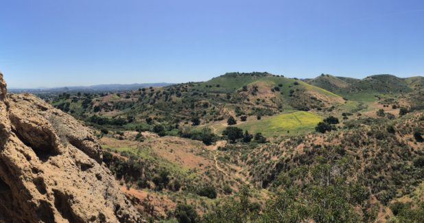
The SoCal summer heat is finally here and unfortunately that means my apartment is at least 30 degrees hotter than it is outside. To make matters worse, our apartment complex pool is consistently packed with tiny humans splashing around playing Marco Polo, and trying to find parking at the beach is a disastrous meltdown waiting to happen. However, I refuse to waste my summer sitting on my couch, watching Netflix and eating entire boxes of popsicles. Thus, I have embarked upon a mission to hike my way around Southern California, with a backpack full of fruit-roll ups, water bottles, and sunscreen that smells oddly like bananas. Here is a list of the best trails, swimming holes, and cliff jumping spots that I have found along my adventures. If you so choose to follow in my footsteps, always remember the most important rules of hiking: Hydration, sunscreen, snacks, and ALWAYS pick up your trash.
Black Star Falls
Overview: Black Star Canyon is a remote canyon set in the Santa Ana Mountains. While during daylight it is visited by many pleasant hikers and mountain bikers, once night falls it is regarded for its bloody and gruesome history, and even said to be extremely haunted. In the 1800s it was home to the Shoshone Indians, who raged war against invading Spaniards. The site is infamous as an Indian burial ground. Years later, after the canyon was taken over by American ranchers, a shoot-out over the price of a horse left one James M. Gregg dead. Furthermore, it is rumored to be the secret meeting site for the KKK and the final resting place of a renegade bus, which veered off a cliff and landed in the canyon, killing everyone inside. I don’t much believe in hauntings or the afterlife, however, even I know that some things are just better left untouched. Stick to hiking during the day. Even if you escape encountering a ghost or two, local law enforcement tends to ticket and/or tow vehicles at night after the area is closed to the public, and mountain lions are a real thing.
Getting There: Take Jamboree Rd in Irvine, CA to East Santiago Canyon road, and turn right. Take a left onto Silverado Canyon Road, and then an almost immediate left onto Black Star Canyon Road. Follow this road until you reach a parking lot. On weekends the area is heavily trafficked so you should have no trouble finding the trailhead.
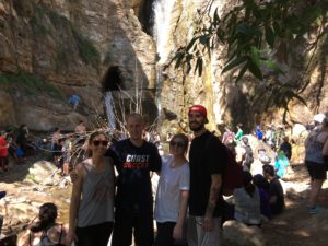
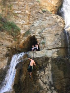
The Trail: The trail is well marked. Follow it to the end of the straight path as it curves around a bend to the right. You’ll pass an electric fenced area, and go over two bridges, before the trail will finally take a sharp u–turn uphill. At this turn you will find the marker for Black Star Falls, which takes you down in to the creek. Follow the creek upstream, and as the boulder climbing gets more and more intense, know that you are almost there. I read many reviews that said the hike was not suitable for children because of the size of the boulders, however, the children seemed to be having the easiest time getting up and around them (while I wheezed asthmatically, inhaler in one hand, water in the other). At the end of the hike you will be greeted by a giant 65 foot tall waterfall, which breaks through the roof of a cave creating a swimming hole inside of it. I am 5 foot 2 and not very active, and I had no trouble climbing up the waterfall into the cave.
Time: 5-6 hours depending on how long you stay at the falls.
Tips: Bring at least 4 bottles of water per person, some snacks, and a towel. While most of the hike is shaded by trees, the beginning 2.5 miles is direct sunlight, so wear sunscreen! Your shoes WILL get wet. Take caution and watch for rattlesnakes and poison oak.
Ladder Canyon
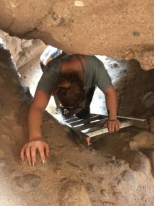
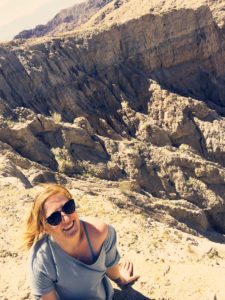
Overview: Ladder Canyon is a hike through a slot canyon, with convenient man placed ladders that help you climb to the top of a ridge with a gorgeous view of Coachella Valley. You then follow a trail down the side of the canyon and wind your way back to the parking lot.
Getting There: 66th Ave in Mecca, CA, turns into Box Canyon Road. Follow Box Canyon and turn left onto Painted Canyon Road. Painted Canyon Road is a very rocky dirt road. We were able to make it down the road in my Chrysler Sebring Convertible, however, it was very slow going and stressful. Highly recommend roping in a friend with 4 wheel drive or a lifted vehicle. The road eventually dead ends in a dirt parking lot.
The Trail: The trail winds its way through a valley in between tall cliffs. Conveniently, there are large arrows made out of rocks on the floor that will mark your way. Unfortunately, we did not see these arrows, so we did the whole loop backwards. We hiked the 4 miles UPHILL on sand, to the very top of the canyon, and then took the ladders down. PAY ATTENTION and find the arrows.
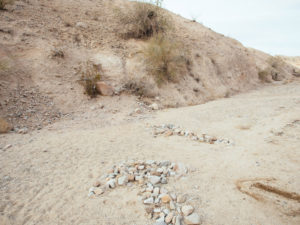
At about .5 mile in, you will see the first arrow pointing you into the slot canyon, where you will climb multiple ladders to the top of the canyon. There is a .5 mile walk along the ridge line, and then the trail turns steep down a cliff side, and loops back around to the parking lot. At this spot where the trail curves sharply down, you will notice a line of rocks blocking the way into the back of the canyon, and instead steering you back to safety. We watched two hikers pass that row of rocks and take off running with only one water bottle, unaware that they were going the wrong way. They were later airlifted out of the canyon. Seriously, pay attention to the floor. Notice the arrows.
Time: 5 hours
Tips: BRING SO MUCH WATER AND SO MUCH SUNSCREEN. Also, the wind and dust through the canyon will chap your lips, so chapstick is a godsend. To be honest, I think hiking the loop backwards is better.
Cave of Munits to Castle Peak
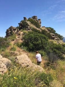
Overview: The Cave of Munits is said to have been the home to a powerful Chumash Shaman, who was put to death after he murdered the son of a very powerful chief. It is very rich in history and absolutely awe-inspiring. You can take the short hike to the cave, and then continue on up the mountain and along the ridge to the nearby Castle Peak, (from the Chumash Kas’elew), which was a ceremonial site used by the Chumash to celebrate solstices.
Getting There: Take the 101 Freeway and exit Valley Circle Boulevard. Turn left on Vanowen Street. Park anywhere on the side of the road, taking care to be respectful as this is a neighborhood. A sign labeled El Scorpion Canyon Park marks the trailhead.
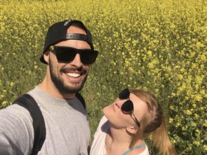
The Trail: The trail is well marked, stay on the main portion forging straight until you see the Cave to your right. (Before you hike up to the cave check out to flower field to your left for a great social media opp!) The trail up to the cave is very short and very steep, and at one point you have to use the help of a rope to hoist yourself up and actually climb into the mouth of the cave. From there, you can climb out the top of the cave, and hike straight up to the top of the mountain. There are many trails that lead up and some are overgrown with flowers and weeds, however as long as you are going up, you are going the right way. Once you reach the ridgeline, turn to your right and follow the ridge all the way to Castle Peak for a gorgeous view of the entire city. The trail then takes a sharp turn to the right and straight down. Going down is very steep, but doable if you take it slow.
Total Distance: 2.6 miles
Time: 2-3 hours
Tips: White noise syndrome is caused by a fungus found in caves in California, and it kills bats. If you choose to go on this hike, please help stop the spread of this fungus and make sure that nothing you are wearing has been in any other caves. 3-4 water bottles per person.
Aztec Falls
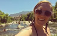
Overview: Aztec falls is a short mile or so hike to a giant swimming hole and a 20 ft. waterfall. There is plenty of room to swim around, and even a spot to jump off a cliff into the pools below. The surrounding area is shaded by trees and a cove in the back is lined with a sandy beach to have lunch on.
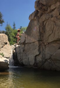
Getting There: YOU WILL NEED 4 WHEEL DRIVE, OR A LIFTED VEHICLE. From Lake Arrowhead, take the 173 to Hook Creek Road. Hook Creek Road turns into Squint Ranch Road. Follow the ever so sketchy Squint Ranch Road, passed the first cabin, and then take the LEFT fork. Follow this all the way until it dead ends at a parking lot. We were lucky that we went on a weekend and there was a lot of foot traffic so we were able to stop and ask for directions. You must purchase an adventure pass to park your vehicle at this location. The pass costs $5.00 and can be purchased at the 7-11 (298 Holiday Dr, Lake Arrowhead, CA 92352) along the way. Highly recommend buying a pizza Lunchable as well.
The Trail: If you are standing in the parking lot, facing the bathroom, turn to your left and walk towards the trailhead. Follow the trail for a short while before you come to a bridge. Do not cross the bridge. Continue along this trail. Blue painted rocks and arrows will mark the spot where you leave the trail and start your descent into the canyon and arrive at Aztec Falls. You will hear the laughter, music and splashing guiding your way.
Total Distance: 2 miles total.
Time: The hike only takes about 20 minutes, but we spent 4 hours at the swimming site, jumping off the cliffs.
Tips: Wear a swimsuit. Bring towels, sunscreen and plenty of snacks and water. If after jumping off the cliffs a few times you would like more privacy, the creek has many shaded locations with flowing water where you can swim and hang out. Follow the trail back towards the parking lot to find these locations.







Sounds like you had an interesting and adventurous summer. What fun.
All of these sound fantastic! Your writing is motivational and the pictures are spot on!